


By ROGER SIMMONS and RICHARD TRIBOU ORLANDO SENTINEL |AUG 26, 2019
Tropical Storm Dorian, packing 60 mph winds, now has parts of Florida in its projected path, according to the National Hurricane Center.
In its 5 p.m. Monday advisory, the NHC said it expects Dorian will be a Category 1 hurricane with 80 mph winds by Wednesday as it passes over or near Puerto Rico. Then the storm is forecast to pass over or near the island of Hispaniola before heading toward the Bahamas and Florida.
The five-day forecast calls for Dorian to be a tropical storm as it approaches Florida, but there is not a lot of confidence in what the storm’s strength may be that far in the future. “The intensity forecast remains something of an enigma,” hurricane center forecasters noted.
“Interaction with Hispaniola and possibly Puerto Rico should result in some weakening in 72-96 hours, followed by restrengthening on days 4 and 5 when Dorian will be moving over the very warm waters in the Bahamas in low shear conditions,” the hurricane center said. “Most of the global models … are now showing pronounced strengthening while Dorian is moving near or through the Bahamas.
“However, confidence in the intensity forecast at days 4 and 5 is very low given the uncertainty about how much of Dorian’s core will interact with Hispaniola.”
Tropical-storm-force winds could be felt in South Florida as early as Friday and in Central Florida by Saturday, based on the NHC’s forecast.
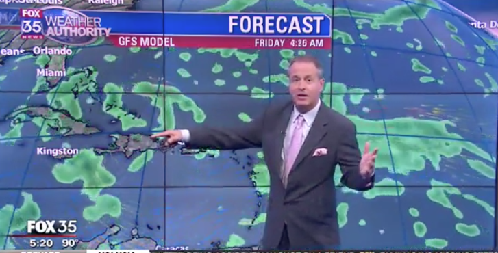
“Tropical Storm Dorian will become a hurricane within the next 36 hours,” WOFL-Fox 35 chief meteorologist Glenn Richards said Monday evening. “I am expecting Dorian to weaken late week by wind shear and mountain disruption … but it may survive the attack and could continue towards Florida for your Sunday-Monday.”
The National Hurricane Center said now is the time for Floridians to pay attention to the storm.
“While uncertainty is high, wind and rain impacts are possible in the Bahamas and Florida later this week and this weekend. Residents in these areas should monitor the progress of Dorian and ensure that they have their hurricane plan in place,” the hurricane center said.


Fox 35 meteorologist Jayme King echoed those sentiments.
“I’ve been doing this 21 years, and I can tell you this track will change many, many times,” King said. “It’ll scare us, we’ll be relieved, then we’ll be scared again. It’s important just to be ready to go should this come a little bit closer to the region as proposed right now.”
As of 5 p.m. Monday, Dorian’s center was located about 60 miles east-southeast of Barbados and 165 miles east-southeast of St. Lucia. The storm was moving west-northwest at 14 mph with maximum sustained winds near 60 mph with higher gusts and tropical-storm-force winds extending 45 miles from Dorian’s center.
The storm was moving west-northwest at 14 mph. “This motion is expected to continue through Tuesday night, followed by a turn toward the northwest on Wednesday,” forecasters said.

The center of Dorian is expected to move near the Windward Islands Monday night and move into the eastern Caribbean Sea on Tuesday. After that, Dorian is expected to pass near or south of Puerto Rico on Wednesday and approach Hispaniola on Wednesday night.
“Some strengthening is forecast during the next few days, and Dorian could be near hurricane strength when it passes through the northern Windward Islands on Tuesday, and it is expected to be a hurricane when it moves near Puerto Rico and eastern Hispaniola,” the hurricane center said.


A Hurricane Watch is in effect for St. Lucia. Barbados, Martinique, St. Lucia, St. Vincent and the Grenadines are under a Tropical Storm Warning, while Puerto Rico, Dominica, Saba, St. Eustatius, Grenada and its dependencies are under a Tropical Storm Watch.
Rainfall of 3-8 inches — with isolated totals as high as 10 inches — are expected from Martinique to St. Vincent, the NHC said. Rainfall of 2-4 inches is expected for Puerto Rico and St. Croix.
Meanwhile, a system that had been hanging around Florida before heading out into the Atlantic officially became a tropical depression on Monday evening.
Tropical Depression 6 had maximum-sustained winds of 35 mph on Monday evening, and is expected to become Tropical Storm Erin by late Monday or on Tuesday.
“The cyclone is expected to begin to accelerate northeastward on Wednesday, and this general motion should continue through Thursday,” forecasters said. “On the forecast track, the center of the depression will remain well east of the east coast of the United States.”