The storm is expected to bring about 1.5 to 3.5 inches of rain to the Los Angeles and Ventura county valleys, with 2 to 5 inches falling over the mountains, according to the National Weather Service.
The Weather Service tweeted out a link to find the latest rainfall totals from the storm.
A flash flood watch that was issued Thursday night for the Los Angeles County burn areas has been allowed to expire, the Weather Service tweeted Friday morning.
The showers, which have been heavy at times, have caused flooding on our local freeway and are likely responsible for dozens of crashes overnight.
The bad driving conditions have continued into Friday. A SigAlert was issued for the two right lanes of the southbound 14 Freeway at Crown Valley Parkway because of flooding.
All lanes were blocked on the eastbound 10 Freeway near Santa Fe Avenue through the downtown areas after a big rig overturned, forcing officials to temporarily close all of the lanes.

It was unclear if weather conditions were a factor in the crash, but the area has been prone to flooding in the past.
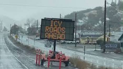
The 5 Freeway through the Tejon Pass remained open Friday morning despite a mix of rain and snow falling overnight on the Grapevine area.
Heavy snow was falling, and accumulating quickly, at the higher elevations of our local mountains.
A winter storm warning was in place through 3 p.m. Friday for some of our local mountain areas above 5,000 feet.
Forecasters are calling for 3 to 8 inches between 4,500 to 5,500 feet. From 1 to 3 feet of snow is possible above 6,000 feet.
Snow levels were expected to drop to the 4,000 foot mark.
Forecasters also warned of gusty south winds with Friday’s storm. Mountain areas could see gust to 60 mph through the day.
Windy conditions could lead to downed trees and power outages.
Source: KTLA5