BY SOO KIM ON 10/30/19 AT 7:38 AM EDT
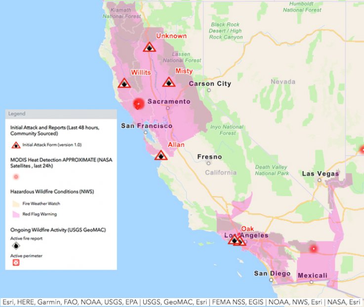
The ongoing California fires has prompted the National Weather Service (NWS) to issue its first-ever “Extreme Red Flag Warning,” with Santa Anna winds that “could be one of the strongest of recent memory” expected for much of Los Angeles and Ventura counties.
The unprecedented warning was issued from 11 p.m. (local time) Tuesday and is effective through 6 p.m. (local time) Thursday.
A Red Flag Warning is issued when warm temperatures, very low humidities, and stronger winds are expected to combine to produce an increased risk of fire danger within the next 24 hours, according to the NWS. The latest enhanced Red Flag Warning indicates an extremely elevated level of dangerous fire weather conditions.California Fires Cause ‘Hazardous’ Air Quality, People Told to Stay IndoorsREAD MORE
“A strong Santa Ana wind event is expected through Thursday, and could be one of the strongest of recent memory. Damaging wind gusts between 50 and 70 mph are expected over most of Los Angeles and Ventura Counties, isolated gusts to around 80 mph likely,” the NWS warned, according to post of the warning by the official U.S. Emergency Alert Twitter account.
“Although the air is cold, humidities will lower to the single digits nearly everywhere by Wednesday and Thursday, and down to 1 or 2 percent in the driest windiest locations. Overnight recoveries Wednesday night will be near zero. This all adds up to an extreme fire weather threat. Use extreme caution with any potential ignition sources, and residents in high fire risk areas should be ready and set to evacuate if emergency officials say so,” the warning added.
There are currently 7 active large fires in California which have covered 97,511 acres so far, according to the National Interagency Fire Center (NIFC).
“The next round of Foehn Winds [dry, down-sloping winds] will begin to ramp up tonight [October 29] across Northern and Central California today and tonight. Expect another extended period of critical conditions in the prone areas. Dry conditions will continue across most of the West as a high pressure ridge over the eastern Pacific Ocean begins to approach the coast late in the day,” NIFC warned.
SOURCE: NEWSWEEK . https://www.newsweek.com/california-fire-map-update-getty-kincade-tick-burris-oak-1468633