A weary, storm-soaked California is bracing for another bout of heavy rain, power outages and potential flooding this week as a cold weather system takes aim at the state.
Light rain was falling in many regions Monday, the first day of spring, with precipitation expected to gain strength early Tuesday and linger into Wednesday.
Unlike recent warm atmospheric river storms that pulled moisture from the tropical Pacific, the incoming system will be a “cold, powerful, dynamic storm coming out of the northwest,” said David Sweet, a meteorologist with the National Weather Service in Oxnard. The greatest effects are expected in Southern California.
Lower mountain and foothill areas around Los Angeles could see up to 4 inches of rain, with up to 3 inches possible along the coast and in valleys, Sweet said. Up to 4 feet of snow is possible at elevations above 6,000 feet with a significant threat of avalanches.
Damaging winds — including gusts of up to 60 mph in coasts and valleys and up to 80 mph in mountain and desert areas — are possible, which could down trees and cause power outages. But the arrival of more moisture remains a top concern.
“We’ll have our eye on [wildfire] burn areas, we’ll have our eye on just about any location, really, for the possibility of flooding,” Sweet said. “At this point, we’ve gotten so much rain that any additional rain has the potential to cause problems.”
That was certainly the case in Central California, where Tulare County residents continued to deal with flood threats from surging rivers and breached levees.
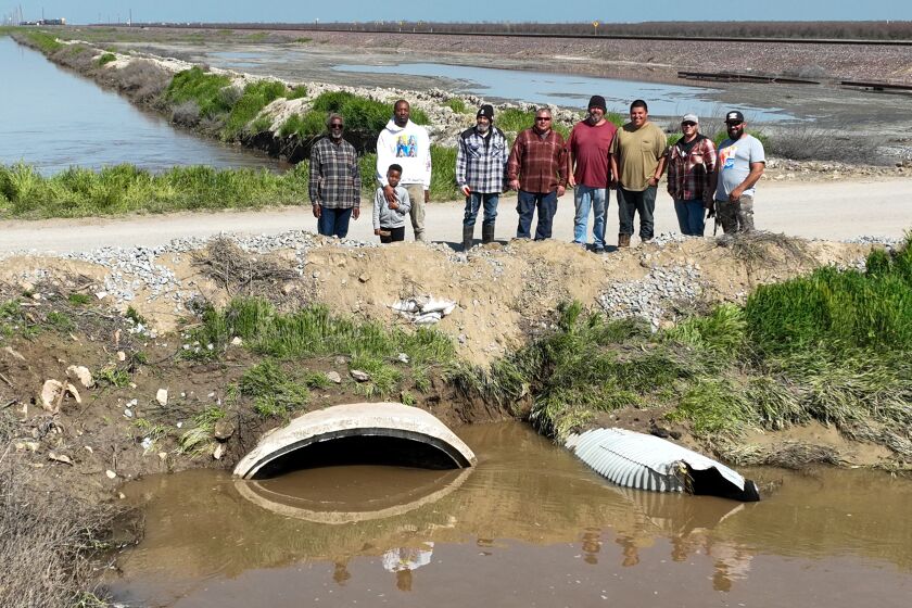
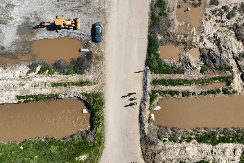
The Tulare County Sheriff’s Office on Sunday ordered evacuations in Alpaugh and Allensworth due to a nearby levee breach, with at least one official indicating the breach may have been caused by someone intentionally cutting through an earthen barrier with machinery.
Evacuations were also underway in Porterville along both banks of the Tule River due to erosion and high water levels, officials said. More than 100 people were in emergency shelters in Exeter, Ivanhoe and Porterville.
Tulare County Fire Chief Charlie Norman said Sunday that more than 11,000 people live in communities covered by mandatory evacuation orders and 3,700 more in areas with evacuation warnings.
Both areas are threatened by water flowing out of the mountains into Lake Success, said Carrie Monteiro, spokeswoman for the Tulare County Emergency Operations Center. Over the weekend, the lake’s spillway was releasing as much as 7,000 cubic feet of water per second to make room for incoming flows, putting additional pressure on the river and tributaries downstream.
Though the incoming storm is expected to bring less rainfall, “our waterways are significantly stressed,” Monteiro said.
“We have over 500 personnel working on this incident, ready, prepared for wherever a levee break or breach may happen because our canals, waterways, creeks and streams are very, very saturated, very stressed, and not used to having this amount of water,” she said.
Though the breach near Allensworth has been temporarily repaired, it’s a “Band-Aid,” she said.
“We are going to have some significant work ahead of us to go back and re-engineer and re-secure these breaks, and with these incoming storms, we know we’re going to have more runoff and more water,” Monteiro said.
At least seven homes have already been destroyed by floodwaters, primarily in Springville, while 62 structures have suffered major damage and 177 minor damage.
Officials are asking the public to remain alert and be ready to leave should another breach occur. Tulare County residents are encouraged to sign up for emergency notifications at AlertTC.com.
Forecasters said the incoming storm is expected to bring more rain to the area Tuesday and Wednesday, including the chance of thunderstorms. The southern Sierra Nevada could see up to 4 feet of snow in areas around Yosemite.
However, much of the focus Tuesday will be on Southern California. In Orange County and the Inland Empire, rainfall totals are likely to range from 1.5 to 2 inches, with storm activity ramping up late Monday and continuing through Wednesday, according to Samantha Connolly, a meteorologist with the National Weather Service office in San Diego.
“We are expecting some flooding to occur in the low elevations, with decent road flooding — especially those low-lying roads in urban areas that have poor drainage,” she said.
The additional showers will threaten to further saturate hillsides already thoroughly soaked after weeks of wet weather. In San Clemente, several buildings were evacuated last week following a major landslide — and officials warned additional rain could exacerbate the danger.
“There is more rain on the way. If you live in an area that is susceptible to flooding, land slide or other hazards, please be observant and report anything that you feel needs to be inspected,” San Clemente Mayor Chris Duncan wrote in a community message Saturday.
Fresh snow is expected in the San Bernardino Mountains, where at least 13 people were found dead this month after a historic blizzard trapped residents in their homes. Snowfall totals won’t be anywhere close to those seen during that storm, but areas around Wrightwood and Big Bear Lake could see 3 feet or more of new powder.
San Bernardino County officials said they are pre-positioning equipment and mobilizing swift-water rescue teams, as well as public works and flood control crews, in anticipation of the latest storm. County officials urged residents — particularly those in the mountains and areas prone to flooding — to stock up on necessary supplies and limit travel during adverse weather.
“Residents and businesses should be aware that plowing all county thoroughfares and roads takes time, and that priority is given to main arteries,” officials wrote in a community bulletin over the weekend. “A snowplow not being visible on your street does not mean county crews are not out in full force. They will arrive.”
Elsewhere in the state, residents were similarly girding for more wet weather. Light rain in the San Francisco Bay Area on Monday will give way to heavier downpours late Monday night into Tuesday, with showers lingering into Wednesday, the weather service said.
The Bay Area can expect up to 2 inches of rain along the coast and in inland hills, but the greatest rainfall totals will be in the Santa Cruz and Santa Lucia mountains, with up to 3 and 4 inches, respectively. Wind gusts of up to 50 mph are possible.
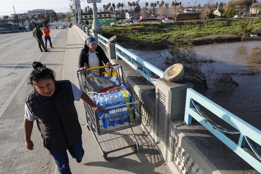
Monterey County, which saw significant flooding along the Pajaro River last week, is likely to avoid more heavy rain, but will see minor street flooding and rising creeks, according to meteorologist Sean Miller of the weather service’s Bay Area office.
“They definitely have seen enough of that,” he said of heavy rain. “Of course, the soils are saturated and it doesn’t take much to break things down.”
In the greater Sacramento area, Shasta County saw heavy rain, small hail and minor flooding Sunday night, while two people in Placer County were hospitalized after a tree fell and struck their vehicles on Auburn Folsom Road. The area will get a break from the weather Monday before showers return Tuesday and Wednesday.
“The incoming system will move close to the coast by Tuesday afternoon, then inland across Central California on Wednesday, bringing an upswing in showers, thunderstorms and heavy precipitation including up to 2 feet of snow in mountain areas,” the weather service office in Sacramento said.
UCLA climate scientist Daniel Swain said in a briefing Friday that one of the biggest threats moving forward isn’t so much another huge flood pulse, but instead a “very prolonged period of high or very high flows” along rivers as the state’s near-record snowpack continues to melt through the spring.
“The real challenge is going to be this very large, cumulative volume of flow and the many, many consecutive days these rivers may be pushing hard against levees,” he said.
All the snow “will eventually melt — it’s just a question of how quickly and when,” he added.
A break in the weather is expected in much of the state Thursday through Sunday, though unsettled patterns may begin again around Monday, said Sweet, the weather service meteorologist in Oxnard.
“We have our eyes on another storm for early next week,” he said.
Times staff writer Ian James contributed to this report.
Source: Los Angeles Times


